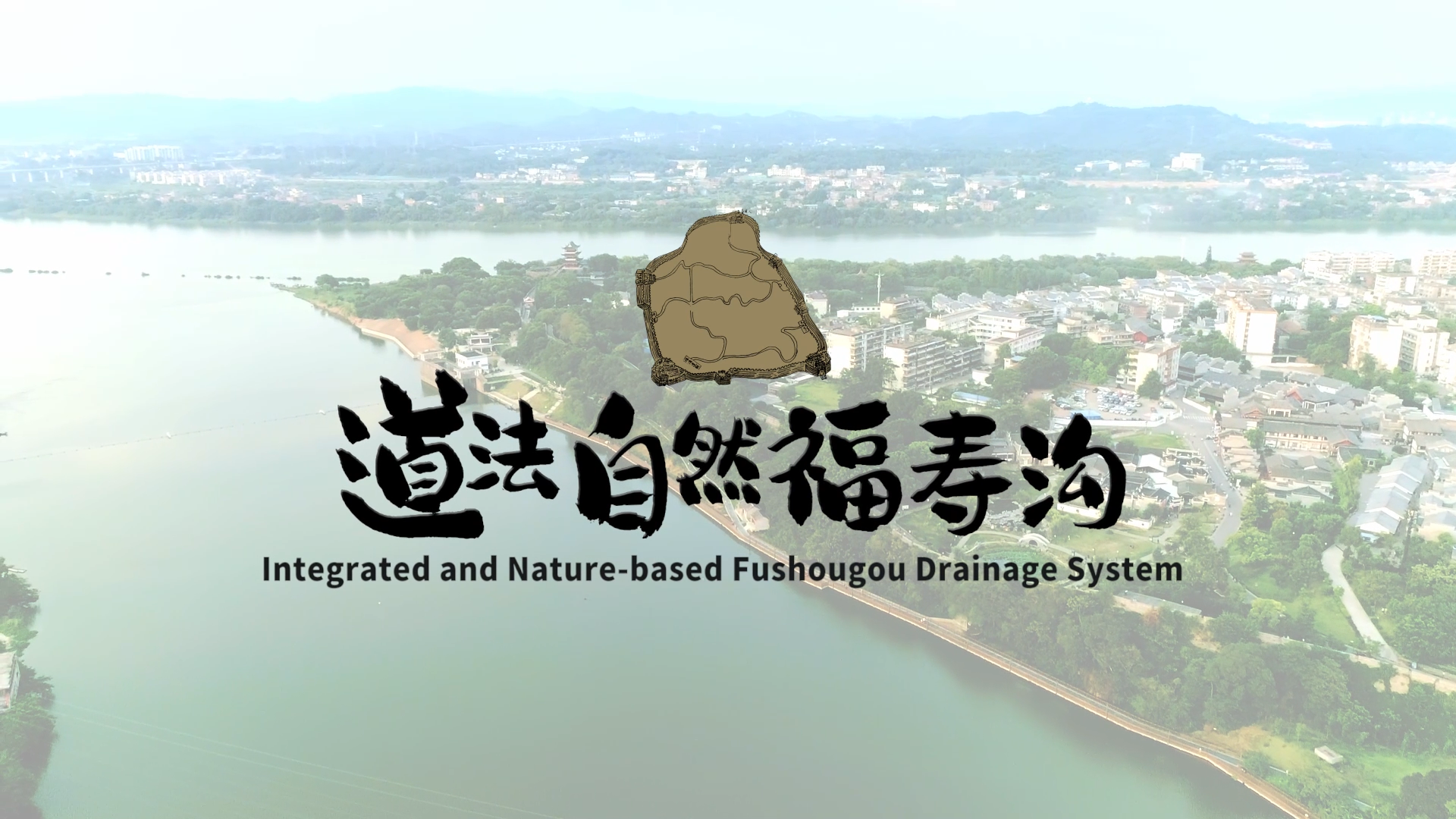
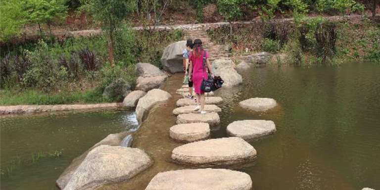
Fushougou drainage system was built over 900 years ago but still in use today. The system adopts nature-based solutions and the sponge city concept in managing sewage, stormwater, and floods. Its indigenous and innovative design integrates grey and green infrastructures, fosters urban ecosystem, and improves micro-climate and people’s wellbeing.
Tag: Water
Building with Nature in the PRC: Integrated Fushougou Drainage System
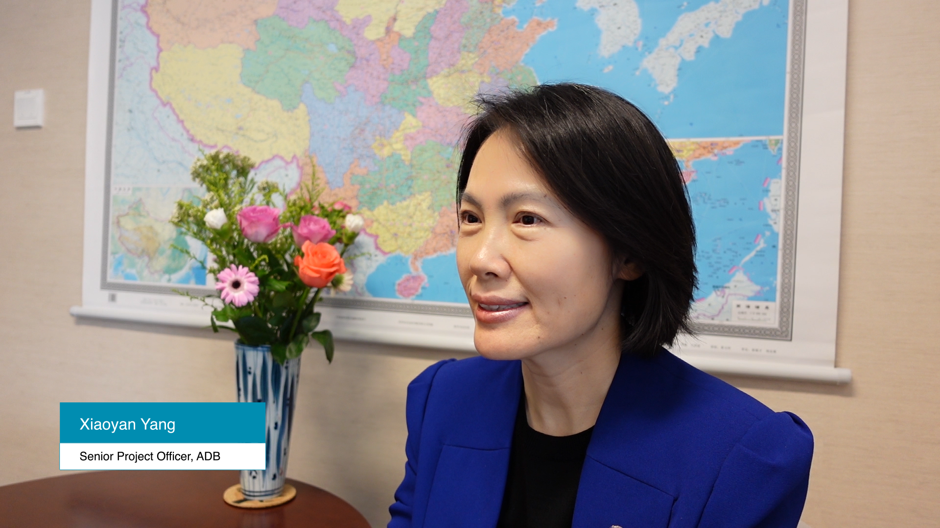
Xiaoyan Yang, Senior Project Officer, ADB, will share the ancient Chinese wisdom behind the Fushougou drainage system built over 900 years ago and is still in use today. The system adopts nature-based solutions and the sponge city concept in managing sewage, stormwater, and floods. Its indigenous and innovative design integrates grey and green infrastructures, fosters urban ecosystem, and improves micro-climate and people’s wellbeing.
How Beijing Is Restoring Its Aquifer
To restore healthy aquifer systems, we need to carefully monitor and manage extraction, and recharge with surface water when available.
For many decades, Beijing had been coping with a water crisis, and has been successful in managing it to a large extent. From 2000 to 2018, the city’s population expanded from 13.6 million to 21.5 million, and its economy grew almost tenfold from CNY316 billion (USD 50 billion) to CNY3,033 billion (USD 500 billion). After an initial increase, Beijing managed to maintain water use at the same level or even lower depending on the end use sector.
The problem, however, is that a majority of the supply was from aquifers, which accounted for about half of total water supply in Beijing. Over-extraction sent the groundwater levels down significantly, although they have gradually recovered in the last few years.
The over-exploitation of groundwater has brought a range of environmental and ecological consequences, including rivers running dry, land subsidence and vegetation degradation. It also increases the risks of depleting Beijing’s emergency water supply.
Beijing is not alone in facing these problems. The North China Plain has more than 160 pocket areas of groundwater depletion. Unsafe levels of groundwater extraction have sunk the city of Jakarta 2.5 meters in 10 years, forcing the government to announce a plan to relocate the capital. The Indus Basin Aquifer is the world’s second-most overstressed aquifer. The overstressed Arabian Aquifer System is already depleted.
The idea of using water transferred from 1,432 km away to recharge the aquifer may seem crazy to many, but there are advantages.
To restore healthy aquifer systems, we need to carefully monitor and manage our extraction, and as is often required, recharge with surface water when available.
Managed aquifer recharge, a relatively new idea, is based on the principle of groundwater replenishment and water banking, which involves the intentional recharge of water to aquifers to maintain groundwater levels, and subsequent storage of this water for future use.
Groundwater aquifers are typically located in soils or deeper rock layers beneath the surface. It requires careful technical design to ensure that water of sufficient quality can infiltrate the ground, stay underground, and be pumped out when needed. It can be used as an underground reservoir, except that it is invisible.
Plenty of research findings support the viability of the technology. But actual implementation on a large scale is still rare. There is often a lack of understanding of cost and benefits. Seeing water “disappearing” can also make it challenging for such an idea to be accepted.
Nonetheless, the city of Beijing decided to give it a try. Since December 2014 it has been receiving water from the Danjiangkou reservoir. By the end of 2019, this supply amounts to 5.2 billion cubic meters of water, which accounted for about a quarter of Beijing’s total water supply during the same period.
Apart from city supply, the Beijing Water Authority diverted some of the water to reservoirs and rivers, and some to aquifers as part of the comprehensive Beijing Capital Region Water Conservation Strategies.
They looked at groundwater storage capacity, recharge methods, different water sources, and water quality and conducted trials to see how the groundwater levels change with recharge and pumping.
The idea of using water transferred from 1,432 km away to recharge the aquifer may seem crazy to many, but there are advantages to this: while the transfer project supplies a stable flow of water, local demand and supply fluctuate.
The managed aquifer recharge can draw the excess water during low demand periods and help maintain a steady flow, and resupply through pumping when demand exceeds supply. In short, it adds an important dimension of flexibility to Beijing’s water supply system.
Innovative designs are critical for this relatively new method to work. For example, in Beijing, sandstorms carry dusts from the Gobi Desert, which can slow down the recharge speed and eventually clog up the system, when deposited into riverbeds.
Researchers can design recharge surface and depth in a way that utilizes wave actions from wind gusts to move deposits away from the center of the riverbeds, thereby increasing the speed the water goes down and reduce the costs of cleaning up.
More importantly, an investment framework is essential for putting managed aquifer recharge up to scale. Such a framework addresses not only technical design but other crucial elements, including social and environmental safeguards, as well as economic and institutional (regulatory, legal, organizational) dimensions, inter alia participation and monitoring. The capacity for the operation and maintenance is also key for the success of managed aquifer recharge.
A sound management plan is crucial for successful management of recharging the aquifer. This is not only related to technical operations and maintenance but also to cost benefit sharing mechanisms. It is easy to collect fees from connected consumers, but much more difficult if people are pumping on their own.
A good plan and strict enforcement therefore ensure the investment will not only see water “disappearing” into the aquifer, but also “coming back” with greater value at the times needed.
The experimental recharge in Beijing has been going on for several years and the results are promising. It shows that storing water underground is technically feasible. In addition to environmental benefits, recovering groundwater levels have shown to be economically and financially more cost effective compared with available surface storage options. An invisible storage with managed aquifer recharge is a better investment option for Beijing, and probably many other areas facing water scarcity.
Authors

Xueliang Cai
Water Resources Specialist, East Asia Department, ADB

Mingyuan Fan
Principal Water Resources Specialist, East Asia Department, ADB
This blog is reproduced from Asian Development Blog.
A Legislative Framework for the Sustainable Development of the Yangtze River
The Yangtze River Protection Law sets a precedent for legislating policies that support the sustainable development and management of rivers.
Overview
Asia’s longest river, the Yangtze River in the PRC, has been facing environmental challenges brought about by rapid economic development and increasing population pressure. Pollution, industrialization, deforestation, unsustainable farming practices, biodiversity and habitat loss, and overexploitation of natural resources threaten the health of aquatic and riparian ecosystems. Failure to systematically curb these threats poses serious obstacles to achieving green and inclusive development.
In 2018, the PRC government saw the urgent need 1) to improve the Yangtze’s ecosystem within a framework of coordinated protection across the basin, 2) to establish a market-based and diversified ecological compensation mechanisms, and, 3) to uphold the protection of the river through the rule of law. These elements were formalized into a legislative framework now known as the Yangtze River Protection Law that took effect on 1 March 2021.
This article summarizes how this law can strengthen environmental protection and restoration of the Yangtze River basin, support the efficient use of resources, ensure harmony between people and nature, and contribute toward overall sustainable development.
This landmark legislation supported by the ADB 1 sets a precedent for developing legislative frameworks supporting the protection and management of other river basins in the PRC. This also serves as a blueprint for developing countries facing similar environmental challenges.
The legislative process for the development of this law involved solicitation of public comments. A total of 83 recommendations were submitted during the first round of public consultation while 17 recommendations were submitted during the second round.
This article is adapted from the study Yangtze River Protection Law of the People’s Republic of China: Overview of Key Provisions and Policy Recommendations published by ADB.
Key Features of the Framework
The Yangtze River Protection Law provides for the following:
The Yangtze River Protection Law stipulates the establishment of a national river basin coordination mechanism to provide centralized guidance and overall coordination of efforts. This includes creating a basin-wide information sharing platform, establishing local coordination mechanisms, and forming an expert advisory committee for professional consultations on major development strategies, policies, and master planning.
This law defines government responsibilities, extensively covering areas, such as river basin planning and layout; green development strategies; resource development, utilization, and conservation; pollution prevention and control; environmental restoration; and financial input for environmental protection, such as ecological compensation. The State Council is required to implement the accountability and evaluation system for environmental protection of the river. The central government and its offices will be responsible for evaluating the progress of local (e.g., provincial and county) governments toward environmental protection and restoration goals.
The Natural Resources Department of the State Council (as well as other relevant departments) is mandated by this law to carry out surveys of the different natural resources in the Yangtze River basin. This is to establish a basic database of these natural assets (i.e., land, minerals, water flows, forests, grasslands, and wetlands); conduct assessments of resource and environmental carrying capacities; and report their status. Survey results will determine the appropriate industrial structure and layout in the river basin, taking into consideration its ecosystems and environmental carrying capacities to give natural ecosystems the time and space to recover.
The law also promotes improved capabilities on disaster prevention, mitigation, resilience, and relief. It requires the strengthening of monitoring, forecasting, early warning, defense, emergency response, recovery, and reconstruction systems for the management of natural disasters, such as floods, droughts, forest and grassland fires, geological disasters, and earthquakes. The provincial governments in the river basin are required to develop the environmental zoning and management plan and the environmental access list based on the state of the ecological environment and resource utilization within their administrative regions.
The Yangtze River Protection Law adopts principles to support green development through measures to improve overall coordination and river basin governance, use of science-based planning, and adoption of innovative technologies. It promotes environmental protection and ecological restoration goals in parallel with a green development approach.
This law incorporates specific provisions on the application of ecological compensation policy measures. These include (i) establishing a compensation system for ecological protection, (ii) increasing financial transfer payments to compensate areas of ecological importance (e.g., sources of the Yangtze River mainstream and its major tributaries) and key water conservation areas in the upper reaches, and (iii) mandating the development of specific market-based measures to support policy reforms.
The Yangtze River Basin Environmental Supervision and Administration Agency, an agency under the Ministry of Ecology and Environment, is primarily responsible for environmental supervision, administrative law enforcement, and all related basin-wide management and monitoring activities. Strengthening its law enforcement capacity leverages its role in the overall supervision of pollution control and ecological protection. Sufficient fund and resources will enable it to effectively carry out its expanded responsibilities.
Recommendations
Efforts to promote law enforcement will remain critically important to ensure that the maximum extent of desired outcomes is achieved. As with any new legal framework, this law will be subject to ongoing review to adapt to varying circumstances and practical needs that arise from its implementation.
At this point, the Yangtze River Protection Law has no clear provisions on climate change or technical guidelines for law enforcement. Land use and spatial planning for the Yangtze River basin needs to consider climate change impacts. The specific plans and goals may be subject to review and update depending on the climate change planning scenarios, the economic growth projections, and the state of environment and ecological systems.
Article 79 of this law stipulates that citizens, legal persons, and unincorporated organizations have the right to access, upon application, information about the river basin in accordance with the law. Information disclosure will need to be supported by an integrated information sharing platform to assist basin-wide spatial planning and decision-making. This can be an avenue to share knowledge and inform legislative frameworks planned for other river basins in the PRC and other countries.
To maintain the Yangtze River Protection Law’s momentum, an implementation plan that is regularly reviewed is critical. It should also specify the division of responsibilities of the relevant departments of the State Council and the provincial governments in the Yangtze River basin. Standards and targets should also be reviewed with each update of the plan to remain relevant.
1 The ADB provided technical support and policy advice in the formulation and design of the Yangtze River Protection Law, preparing a series of policy recommendations that were submitted to the Ministry of Ecology and Environment (MEE) and the National People’s Congress (NPC).
References
Asian Development Bank (ADB). 2021. Yangtze River Protection Law of the People’s Republic of China: Overview of Key Provisions and Policy Recommendations. Manila.
Author

Au Shion Yee
Senior Water Resources Specialist, East Asia Department, ADB
This blog is reproduced from Development Asia.
CAREC Institute Water Dialogue Series on Sustainable Water Governance in Central Asia
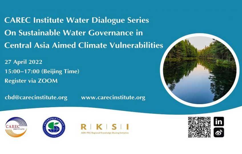
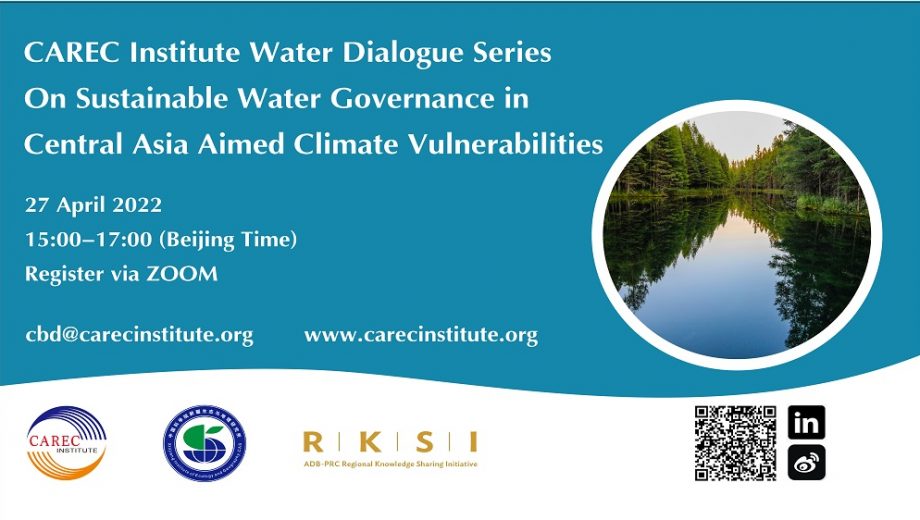
In April 2022, the CAREC Institute, in partnership with the ADB, RKSI and Xinjiang Institute of Ecology & Geography, CAS (XIEG), will deliver a regional water dialogue based on “Water Footprint Analysis of Central Asia”, an analytical study conducted by Water Footprint Implementation (WFI) and supported by Swiss Agency for Development and Cooperation (SDC) within scope of Blue Peace Initiative. This is the second dialogue on sustainable water management in Central Asia.
The overall aim of this dialogue is to facilitate open discussions among leading water management experts on pathways to sustainable, climate adaptive water management systems in Central Asian countries. Also, to discuss, analyze and select practical implications of Water Footprint report for Central Asia and to further explore potential coordination mechanisms among ADB/CAREC Water Pillar, regional projects, initiatives, and activities of all stakeholders in Central Asia.
In addition to organizing bodies and development partner experts, relevant experts and interested wider audience from across the CAREC region and beyond are expected to participate in the dialogue.
CAREC Institute has started series of water dialogues with development partners and stakeholders in the CAREC region. The main aim of the CAREC Institute water dialogue series is to analyze the crucial role of water in ongoing and post-COVID developments as well as longer term sustainable growth of the CAREC region. The first dialogue was conducted on 10 February 2022.
Register here to participate.
Agenda:
| Time | Program |
|---|---|
| 10:00 – 10:20 | Opening Ceremony Moderator: Ms. Li Linyi, Deputy Director of International Exchange Division, International Poverty Reduction Center in China (IPRCC). Welcome Remarks: Ms. Li Xin, Deputy Director-General of IPRCC. |
| 10:20 – 12:00 | Country Presentation I Moderator: Ms. Li Linyi, Deputy Director of International Exchange Division of IPRCC. Commentator: Dr. Zhang Chuanhong, Associate Professor of China Agricultural University. Speakers (20 minutes each): 1. Diversification of Income for Poor Farmers. Mr. Horn Kimhong, Program Coordinator, Dan Church Aid, Cambodia. 2. PRC Aided Pilot Project of Poverty Reduction Cooperation in Myanmar. Mr. Win Kyaw Myo, Director, Department of Rural Development, Ministry of Cooperatives and Rural Development, Myanmar. 3. Mr. Htun Htun Oo, Second Secretary, Embassy of Myanmar. 4. Exploration and Experience: Rural Revitalization in the PRC. Dr. Xu Jin, Associate Professor, China Agricultural University. |
| 12:00 – 14:30 | Break |
| 14:30 – 16:00 | Country Presentation II Moderator: Ms. Maha Ahmed, Deputy Country Director, World Food Programme. Speakers (20 minutes each): 1. Singapore’s Approach to Social Assistance and Community Development. Ms. Lau Amanda, Manager, Ministry of Social and Family Development, Singapore. 2. Tourist Attraction/Learning Community, Baan Nam Sap Learning Center. Mrs. Suttapak Panpapai, Foreign Relations Officer, Professional Level, ASEAN Unit, Office of Permanent Secretariat, Ministry of Interior, Thailand. 3. D-Hope Project Thailand. Mrs. Nicha Premchan, Foreign Relation Officer, Professional Level, Department of Community Development, Thailand. 4. Case Introduction and Video Presentation of Hesilu Village in Zhejiang Province. Mr. He Yunhui, Party Secretary of Hesilu Village, Zhejiang Province, the PRC. |
| 16:00 – 16:20 | Closing Ceremony Closing Remarks: Mr. Miguel Musngi, Senior Officer, Poverty Eradication and Gender Division of the ASEAN Secretariat. |
基于生态系统的综合生态保护与绿色发展模式案例:中国黄山项目
Yangtze River Protection Law of the PRC: Overview of Key Provisions and Policy Recommendations
Daring to Aspire: Students as Partners in Water Stewardship in Uvurkhangai, Mongolia
Fuzhou Environmental Improvement Project in the People’s Republic of China
Restoring a River the Natural Way
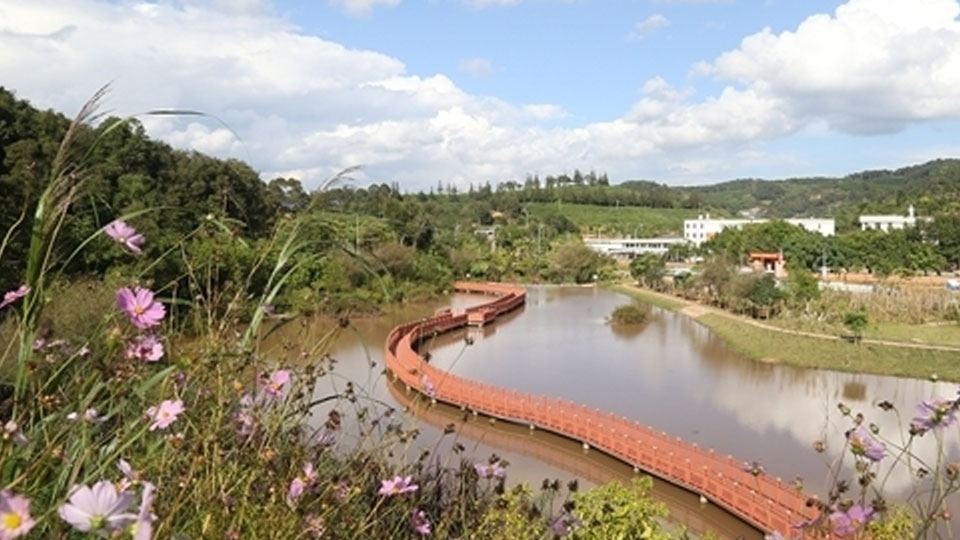
In the People’s Republic of China, rehabilitation of the Simao River took an ecological and green development path and was integrated into city plans.
Overview
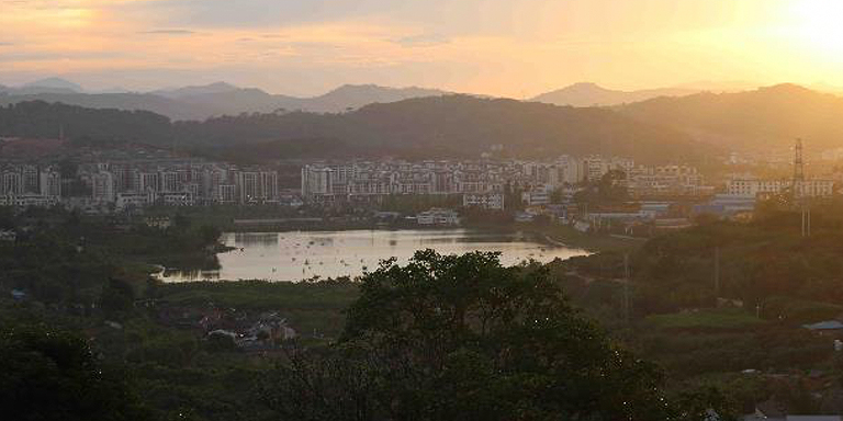
The Simao River in Pu’er City, the People’s Republic of China (PRC) was rehabilitated to prevent flooding in the city, restore the area’s biodiversity, and improve livability for residents.
In 2012, the city government worked with the Cities Development Initiative for Asia (CDIA) to finalize the design of its rehabilitation project, which aimed to develop Simao River into an attractive landmark and improve its flood protection capacity. Soon after, KfW (German Development Bank) approved an $80-million loan to implement the key components of the project.
In 2018, CDIA development experts returned to Pu’er and saw that the measures implemented by the city, which largely adopted a nature-based approach, resulted in better flood control and more sustainable river management, improved water quality, and restored ecology of the river. Residents were also using green spaces near the river for recreation and social interaction.
Project information
PRC: Flood Control, Environmental Improvement and Water Reclamation Works in Pu’er
Project snapshot
- Start date: January 2012
- End date: June 2012
- Total project cost: $410,000
- Financing:
- KfW: $80-million loan for key components of project
- CDIA: $410,000 in technical assistance
- Municipal Government of Pu’er
- Commissioning agency: Municipal Government of Pu’er
Context
Pu’er City is situated in the southwest of Yunnan Province. It covers a floodplain of about 45,000 square kilometers, framed by green hills and mountains where the famous Pu’er tea is grown. The city’s estimated population is 200,000.
Pu’er developed into a modern urban center in recent years, but increased urbanization brought pressing challenges. It experienced frequent floods that severely affected urban activities and the future development of the city. The foul odor of garbage and sludge from the Simao River further attested to environmental deterioration.
Challenges
The Simao River traverses the urban area of Pu’er. The 15-km long watercourse acts as a natural drainage channel for the city and serves as a home for wildlife and vegetation along its shores. In previous years, however, the river lost its capacity to provide these environmental benefits.
In 2012, the river had a very low flood risk management capacity that it could only cope with a 5-year flood event or less. Due to the characteristics of the river’s course and riverbeds, it could not effectively drain flood waters, thus putting the city at risk of flooding.
The Simao River was also polluted. Solid waste, sludge, and aquatic plants impeded its normal water flow, and informal settlers occupied some of its riverbanks. Pu’er’s inadequate wastewater management system compounded the problem, as only 22% of the urban wastewater was collected and treated. The rest was discharged directly into the Simao River and its tributaries.
With the river’s poor water quality and surrounding environment, biodiversity could hardly thrive. This was a stark contrast to the rich flora that Yunnan Province is known for.
Pu’er’s residents perceived the Simao River as a heavy burden; they did not see it as an integrated part of their city and did not regard it as an emblematic feature of Pu’er’s natural beauty.
Solutions
The Pu’er Municipal Government prepared a feasibility study of the Simao River rehabilitation project to develop the watercourse into an attractive landmark and to prepare the city to cope with severe flood events.
Comprehensive project preparation
The city government asked CDIA to review the feasibility study and finalize the preliminary design for the Flood Control, Environmental Improvement, and Water Reclamation Works in Pu’er project.
CDIA and the Pu’er government worked closely for 6 months in 2012 to prepare the project, involving all relevant stakeholders at each critical step of the planning process. They collected information and conducted surveys, analyses, and calculations to provide a strong foundation for the design of the Simao River rehabilitation project.
By the end of CDIA’s intervention, the city was set to pursue the following measures:
- Improve the water quality through a series of treatment wetlands at the confluences of Simao River tributaries and storm water channels;
- Provide a river layout that can withstand 50-year flood events;
- Allow the river water to flow through a combination of free-flowing stream and still water sections;
- Provide an open main flood channel with vegetation situated alongside riverbanks; and
- Divide project construction into three sections and three contract packages for the entire length of the river.
In December 2012, KfW signed an $80-million loan agreement with the PRC government to implement flood control and channel improvement works for the Simao River.
Use of ecological and green development approach
The city mostly used nature-based solutions recommended by CDIA to achieve a more sustainable river rehabilitation and create a healthy and livable environment for residents. It espoused the use of ecologically sound and diverse measures, natural processes and materials, and it based restoration efforts on the idea of the features being part of the natural environment and not exclusively built structures. It also planned to entirely use native plant materials for revegetation and for reinforcing flood beds and riverbanks.
The adoption of an ecological and green development approach ensures cost effectiveness in terms of construction and maintenance, and it can also recreate a natural river environment that protects against floods and provides natural habitats for biodiversity.
Integration of the project with city development plans
The city government integrated the planned interventions with their master plan and linked the river works with other relevant urban infrastructure projects, such as wastewater management, wetland park development, and urban renewal. This approach enabled the city to pursue a project design adapted to its existing and future development needs.
Results
CDIA visited the city 6 years after it completed its technical assistance and found that the city completed 85% of the project work, including flood control, sewage interception, and river ecology restoration measures recommended in the CDIA study.
Pu’er officials noted that the risk attributed to flooding has been minimized in flood-prone areas after completion of dredging and excavation works along the river. They also expect that the river will be able to withstand a 50-year flood event when the project is completed.
The river’s water quality improved after the city reformed its wastewater management program, and the foul smell coming from the river was eliminated. There was also a noticeable increase in fish population in the still water sections of the river.
The landscape surrounding the river was rehabilitated, with 50 hectares of greening and restoration efforts along its banks giving residents new spaces for recreation.
The city used natural and indigenous materials and processes during the project and that resulted in low construction and maintenance costs. Pu’er officials are optimistic that an ecological and green development approach will improve biodiversity and promote the sustainable development of the river.
Informal settlers along the river that were exposed to flooding were transferred to relocation sites with better amenities and quality of housing units.
Finally, the roads and bridges constructed and retrofitted near the river are expected to improve mobility and access to social services for residents.
Lessons
Aided by the interventions and the commitment of relevant stakeholders, Pu’er is set to achieve its primary objective of developing the Simao River watercourse into an attractive ecological landmark while eliminating flood risks and improving the water quality of the river.
The integration of the project into the Pu’er City Master Plan paved the way for the coordinated implementation of relevant urban infrastructure projects. Meanwhile, the active participation of city officials and the affected communities in project planning and implementation strengthened their ownership of the project.
The city government linked the various project components with internal and external funding sources necessary to implement the project. It further established a governance structure, headed by the city mayor, to manage and maintain the river and its tributaries after project completion.
Key officials of the Pu’er Municipal Government are optimistic that Pu’er will serve as a model for other cities in the PRC on how to approach the problem of flood management the natural way and how to integrate flood management measures in a more sustainable manner.
References
Cities Development Initiative for Asia. 2012. Final Report: Flood Control, Environmental Improvement & Water Reclamation Works in Pu’er.
R. Baoy, E. Ringhof, and C. Yiyang. 2018. Pu’er Tracer Study. Tracer Studies on City Interventions. Cities Development Initiative for Asia.
Author

Brian Capati
Urban Development Specialist, Cities Development Initiative for Asia
This blog is reproduced from Development Asia.